




 Ashtyn Asay
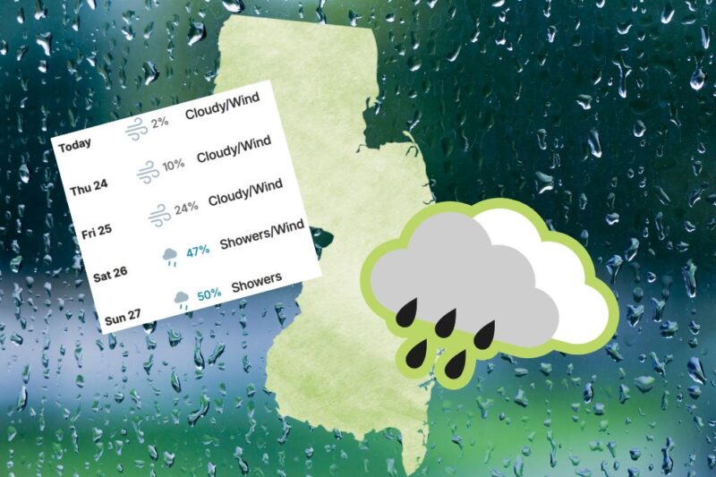
 New Jersey is in the thick of an early-season nor’easter, with the storm strengthening along the East Coast and bringing coastal flooding, high surf, strong winds, and rain to the state through the weekend. The Jersey Shore is expected to see the most significant impacts, with multiple rounds of tidal flooding, dangerous surf, beach erosion, and potentially damaging wind gusts. The National Weather Service has expanded Coastal Flood Warnings to include parts of Monmouth and Middlesex counties, while High Surf Advisories, Wind Advisories, and High Wind Watches are also in effect in portions of the Shore. The storm is expected to continue affecting the region through Sunday, with some rain and gusty winds potentially lingering into Monday. Here’s the latest on what New Jersey residents need to know.
What’s Happening With the Weather?
According to The Weather Channel, a powerful nor’easter is moving up the East Coast, bringing coastal flooding, high surf, rain, and strong winds from North Carolina to New England through the weekend. The most significant flooding is expected along the northern Outer Banks and southern Jersey Shore, while high-tide flooding is also possible along Long Island and the Mid-Atlantic coast. Wind gusts could reach up to 60 mph in parts of the Northeast, with heavy rain potentially causing flash flooding in coastal New England.
Read More: Amusement Park for Sale, Four Restaurant Updates, Plus More News You Missed at the Jersey Shore
The Jersey Shore: The Biggest NJ Impacts
The Shore is where residents should pay the closest attention. The National Weather Service has issued a Coastal Flood Warning for Ocean, Atlantic, Cape May, and southeastern Burlington counties through 3PM Saturday, September 26th. One to two feet of inundation is expected in low-lying areas near shorelines and tidal waterways, with widespread roadway flooding possible. The NWS says moderate tidal flooding could continue into the weekend, and major flooding cannot be ruled out. High Surf Advisories and High Wind Watches are also in place. Strong winds could gust up to 60 mph in some coastal areas, while repeated rounds of high tides could lead to flooding and beach erosion.
Flood Warning for Monmouth and Middlesex Counties
Monmouth and Middlesex counties are now under Coastal Flood Warnings, with the National Weather Service warning of one to two feet of inundation above ground level in low-lying areas near shorelines and tidal waterways. Widespread roadway flooding is possible in coastal and bayside communities, particularly around back-bay areas, and some roads could become impassable. In eastern Monmouth, a High Surf Advisory remains in effect through Saturday evening, with breaking waves up to 12 feet, a high risk of dangerous rip currents, and the potential for significant beach erosion and dune breaching. The NWS is also forecasting multiple rounds of tidal flooding through the weekend, with moderate flooding possible around Saturday morning’s high tide in parts of eastern Monmouth. A Wind Advisory is in effect from Friday evening through early Sunday, with north winds of 15 to 25 mph and gusts up to 45 mph possible across Middlesex and parts of Monmouth County. Residents in flood-prone areas should avoid driving through floodwater.
North Jersey: Windy, Cloudy, and Cooler
Bergen, Essex, and Hudson counties should expect a windy, rainy, and unsettled weekend, with the biggest concern for communities along the waterfront and other low-lying areas. The National Weather Service has a Coastal Flood Advisory from 6PM Friday through 11AM Saturday for Hudson and eastern Essex counties, with one to two feet of flooding possible in vulnerable areas near the waterfront and shoreline. Eastern Bergen is also included in the NWS outlook for northeast New Jersey. Northeast winds of 15 to 25 MPH could gust up to 50 to 55 MPH, with the strongest winds possible near the coast.
See More: Where to See Fall Foliage in New Jersey
What NJ Residents Need to Know
The main takeaway: This is a very different storm depending on where you live. Inland North Jersey is looking at a breezy, cooler, rainy stretch, while the Jersey Shore is dealing with a much more significant coastal threat. If you live near the coast, a bay, or a tidal waterway, pay particular attention to the forecast around high tide. The NWS warns that widespread roadway flooding is possible in vulnerable coastal and bayside communities, with some roads potentially becoming impassable.
If you’re heading to the beach this weekend, keep in mind that the combination of large waves, strong onshore winds, coastal flooding, and dangerous rip currents could make ocean conditions hazardous. The storm’s exact track is still evolving, so residents should check updated forecasts before heading out, particularly on Friday, September 25th, and Saturday, September 26th.
Emergency Resources
For life-threatening emergencies, dial 911. For information about evacuation routes, disaster assistance, and other essential services, residents can contact NJ 211 24/7 by dialing 211, texting their ZIP code to 898-211, or visiting the NJ 211 website. Residents experiencing a power outage can find outage information and utility contact numbers through the New Jersey Office of Emergency Management. For the latest emergency alerts, weather warnings, and preparedness information, residents can also check the New Jersey Office of Emergency Management. Find additional storm emergency resources here.
Follow @thejerseyshoregirl_ on Instagram for the latest Jersey Shore updates, sign up for our weekly newsletter here that shares everything you missed each week, and check out our events calendar, which has over 40+ events weekly to peruse.